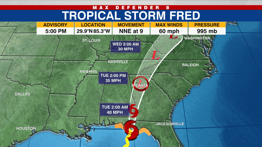
TAMPA, Fla. (WFLA) — Tropical Storm Fred made landfall around 3:15 pm eastern time near Cape San Blas, Florida with maximum winds estimated at 65 mph. Fred will continue to trudge onshore to the north before taking a more northeasterly turn towards the Western Carolinas. This direction will drag moisture and a few bands of rain across the state, including over our area.

Expect a few showers to wander by this evening, with fewer chances for storms overnight, but a stray shower or two cannot be rules out. Temperatures will sink down into the upper 70s.
Tuesday begins with a few more clouds than we are used to for the morning, but the onshore flow will also lend itself to a few coastal showers wandering onshore. Temperatures will warm up to 91 degrees for the afternoon. The coastal showers that wander onshore during the morning to mid day will proliferate over inland counties during the afternoon hours.
Wednesday we begin to dry out a tiny bit, with less enhanced moisture due to Fred, and more normal showers and thunderstorms firing up. A Southeasterly flow set up which means a sunnier, hotter morning and a later, possibly more intense round of showers and storms pushing across the state towards our coastline during the late afternoon, into the early evening hours.
Slightly drier air will decrease rain chances to a 30% by the end of the week, for Friday and Saturday with even warmer temps.
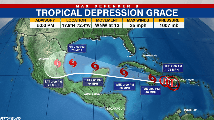
Tropical Storm Grace is now forecast to stay well south of the Tampa Bay area with no impacts expected at this time. Grace will intensify into a Category 1 Hurricane prior to landfall along the eastern coast of Mexico.

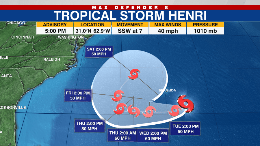
Tropical Storm Henri formed northeast of Bermuda late Sunday but is not forecast to impact the United States.


